
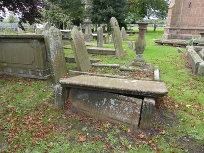
Tombchest of James Phillips, 2 metres south of the sundial in the Churchyard of St Michael
Tombchest of James Phillips, 2 metres south of the sundial in the Churchyard of St Michael, Grade II listed tomb chest in Shotwick, Cheshire, UK
Localização: Puddington
Coordenadas GPS: 53.23859,-2.99529
Última atualização: 2 de março de 2025 às 17:27

RAF Sealand
1.8 km
Shotwick Castle
1.8 km
Shotwick House
2.6 km
St Michael's Church, Shotwick
27 m
Shotwick Hall
309 m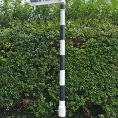
Footpath Guidepost At Junction With Parkgate Road
2.5 km
Gates, gatepiers and churchyard wall along north side of Shotwick Lane
8 m
Front garden walls and gatepiers at Shotwick Hall
299 m
Tombchest of Robert and Martha Ellison, 10 metres southwest of south corner of tower of Church of St Michael
18 m
Manor Farmhouse
131 m
Tombchest of John Nevett Bennett, 5 metres west of south porch of St Michael's Church
8 m
Tombchest of Rev M Reay and 4 children, 8 metres south of south porch of Church of St Michael
14 m
Footpath Guidepost At Junction Of Pipers Lane Opposite The White House
1.9 km
Sundial in the churchyard of St Michael
2 m
Granary 30 metres east of Shotwicklodge Farmhouse
1.5 km
Greyhound Farmhouse
118 m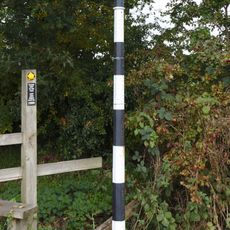
Footpath guidepost 50m east of Heath farmhouse
2.7 km
Former kitchen or bakehouse attached to north east corner of Shotwick Hall
328 m
L-shaped ranges of farm buildings 60 metres north of Shotwick Hall
378 m
Tombchest of William Briscoe (died 1723) and others, 4 metres west of priest's door to St Michael's Church
19 m
Vicarage Farmhouse
85 m
Barn 70 metres north east of Shotwicklodge Farmhouse
1.5 km
Footpath Guidepost 5 Metres North Of Top Lodge
1.7 km
Tombchest of William Briscoe (died 1704) and others, 5 metres southwest of priest's door to St Michael's Church
19 m
North Pair of Aircraft Hangars
1.5 km
South Pair of Aircraft Hangars
1.6 km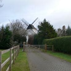
Gibbet Windmill
2.7 km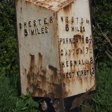
Milepost, Parkgate Road, Woodbank
2.4 kmAvaliações
Visitou este local? Toque nas estrelas para avaliá-lo e partilhar a sua experiência ou fotos com a comunidade! Experimente agora! Você pode cancelar a qualquer momento.
Encontra tesouros escondidos em cada aventura!
De pequenos cafés cheios de charme a miradouros secretos, foge das multidões e descobre lugares que têm mesmo a tua cara. A nossa app torna tudo simples: pesquisa por voz, filtros espertos, rotas otimizadas e dicas genuínas de viajantes do mundo inteiro. Descarrega já para viveres a aventura no teu telemóvel!

Uma nova abordagem para descobrir o turismo❞
— Le Figaro
Todos os lugares que valem a pena explorar❞
— France Info
Um passeio sob medida em apenas alguns cliques❞
— 20 Minutes